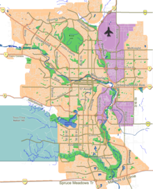
Auburn Bay is a suburban residential neighbourhood in the southeast quadrant of Calgary, Alberta. It is located at the southeastern edge of the city, and is bounded by Seton Boulevard to the south, Deerfoot Trail to the west, 52 Street E to the east and Stoney Trail to the north. It was established in 2005.
The South Health Campus and southeast Calgary hospital is located immediately to the south of the community. The Green Line of the CTrain will run along the community's eastern boundary, parallel to 52 Street.
Auburn Bay has a Residents Association and a Community Association.
It is represented in the Calgary City Council by the Ward 12 councillor.[1]
A diverse community which is home to over 5400 houses. Auburn Bay Community is home to five schools: Auburn Bay K-4 & Prince of Peace K-9, St. Gianna Catholic School K-6, Bayside School K-5, and Lakeshore School 5–9. 15 playgrounds, an off leash dog park, Auburn Station commercial mall, future home to LRT transit, walking/cycling trails, 2 baseball fields, 2 large soccer fields, 2 ponds and a lake.
Demographics
As of the 2021 Calgary municipal census, Auburn Bay had a population of 18,090, living in 6,245 dwellings. With a land area of 4.5 km2 (1.7 sq mi), it had a population density of 4,020/km2 (10,410/sq mi) in 2021.
Residents in Auburn Bay had a median household income of $125,000 in 2021, and 5% of residents were low-income. As of 2021, 26% of residents were immigrants, 19% of housing were condominiums or apartment, and 25% of housing were rentals. 22% of Auburn Bay residents spent 30%+ of their income on housing, compared to the Calgary average of 23%.[2]
Crime
In the May 2023-May 2024 data period, Auburn Bay had a crime rate of 1.039/100, an increase from the previous data period.[3][4]
This puts it at this comparison to other Calgary communities: Auburn Bay (1.039/100), Saddle Ridge (1.358/100), Whitehorn (1.741/100), Rundle (2.342/100), Brentwood (2.348/100), Acadia (2.542/100), Bowness (2.934/100), Shawnessy (3.296/100), Inglewood (3.438/100), Sunnyside (3.650/100), Marlborough (4.703/100), Southwood (5.147/100), Sunalta (5.307/100), Montgomery (5.483/100), Forest Lawn (6.528/100), Rosscarrock (7.049/100), Downtown Commercial Core (12.705/100), Downtown East Village (15.605/100), Manchester (43.368/100).
See also
References
- ^ "Calgary Elections". City of Calgary. 2017. Retrieved November 12, 2017.
- ^ Strategies, Community. "Auburn Bay Profile". www.calgary.ca. Retrieved 2024-10-10.
- ^ Service, Calgary Police. "Calgary Police statistical reports". www.calgary.ca. Retrieved 2024-10-06.
- ^ Strategies, Community. "Community Profiles". www.calgary.ca. Retrieved 2024-10-06.
External links
- Federation of Calgary Communities. "Auburn Bay Community". Archived from the original on 8 June 2007. Retrieved 2007-05-17.
50°53′07″N 113°57′50″W / 50.88528°N 113.96389°W


