| Cards Pond | |
|---|---|
| Location | South Kingstown, Washington County, Rhode Island |
| Group | Salt Ponds of Rhode Island |
| Coordinates | 41°22′25″N 71°34′03″W / 41.3737128°N 71.5675593°W |
| Type | saline |
| Primary inflows | precipitation, groundwater |
| Primary outflows | to sea, breaches 8-10 times a year |
| Catchment area | 1,979.76 acres (8.0118 km2) |
| Basin countries | United States |
| Surface area | 40.95 acres (16.57 ha) |
| Average depth | 1.3 ft (0.40 m) |
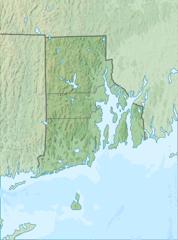
Cards Pond, or Card Pond, is a coastal lagoon in South Kingstown, Washington County, Rhode Island, United States.[1]
Coastal lagoon
It is one of nine coastal lagoons (often referred to as "salt ponds") in southern Rhode Island.[2][3] According to the Rhode Island Sea Grant program, "[i]ts breachway is only intermittently open to the sea", and it receives large quantities of freshwater from Moonstone Stream; only two other salt ponds, Point Judith and Greenhill, have significant streams flowing into them. It is partially within the Trustom Pond National Wildlife Refuge,[1] which is inhabited by over 360 species of animals.[4]
Watershed
Cards Pond's watershed covers 1,979.76 acres (801.18 ha), of which 59.06 acres (23.90 ha) is occupied by water; the pond itself has a surface area of 40.95 acres (16.57 ha), while other, smaller bodies of water account for the other 18.11 acres (7.33 ha).[citation needed] The pond averages 1.3 ft (0.40 m) deep, and has a salinity level of approximately 4 parts per thousand, too low to sustain the growth of eelgrass.[2][5] It has been classified as "non-tidal except when breached by storms".[5] The water directly receives about 51,196,553 gallons of precipitation per year, and at least 1,592,165 gallons of daily groundwater flow.[6] Cards Pond, like others in the region, was "formed after the recession of the glaciers 12,000 years ago".[7] Nests of piping plovers, which are federally designated as a threatened species, have been documented within the watershed.[3]
Flooding
The land surrounding Cards Pond is low-lying, and particularly vulnerable to severe flooding. However, compared to other ponds in the region, damage from future storms is projected to be minimal.[3] It typically breaches around 9 times each year, spilling into the Block Island Sound. When the pond threatens to flood a nearby road or surrounding houses, a breach is intentionally created by the U.S. Fish and Wildlife Service.[8]
See also
References
- ^ a b "Salt Ponds of Rhode Island" (PDF). Rhode Island Sea Grant. Archived from the original (PDF) on May 17, 2008. Retrieved 2009-05-25.
- ^ a b S.W. Nixon and B. A. Buckley (2007). "Nitrogen Inputs to Rhode Island Coastal Salt – Too Much of a Good Thing" (PDF). Rhode Island Department of Environmental Management. Retrieved 2009-05-25.
- ^ a b c "Rhode Island's Salt Pond Region: A Special Area Management Plan" (PDF). Rhode Island Coastal Resources Management Council. Retrieved 2009-06-11.
- ^ "Trustom Pond National Wildlife Refuge". U.S. Fish and Wildlife Service. Retrieved 2009-06-11.
- ^ a b "Cards Pond General Features Data". Rhode Island South Shore Sea Grant. Archived from the original on July 16, 2011. Retrieved 2009-06-11.
- ^ "Cards Pond Freshwater Input Data". Rhode Island South Shore Sea Grant. Archived from the original on October 13, 2008. Retrieved 2009-06-11.
- ^ "What is a Salt Pond?". Salt Ponds Coalition. Archived from the original on 2010-10-09. Retrieved 2009-06-11.
- ^ Donita Naylor (March 11, 2008). "Cards Pond spills seaward". The Providence Journal. Retrieved 2009-06-11.


