Native name: Archipiélago Chinijo | |
|---|---|
 Lanzarote, La Graciosa, Montaña Clara and Alegranza from above | |
 Map of Chinijo Archipelago | |
| Etymology | Small archipelago |
| Geography | |
| Location | Atlantic Ocean |
| Total islands | 5 |
| Area | 40.9 km2 (15.8 sq mi)[1] |
| Coastline | 54.435 km (33.8243 mi)[2] |
| Administration | |
| Autonomous Community | Canary Islands |
| Province | Las Palmas |
| Island | Lanzarote |
| Municipality | Teguise |
| Largest settlement | Caleta de Sebo (pop. 730) |
| Demographics | |
| Population | 734 (2018)[3] |
| Languages | Spanish, specifically Canarian Spanish |
| Additional information | |
| Time zone | |
| • Summer (DST) | |
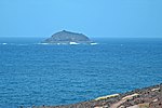
The Chinijo Archipelago (pronounced [tʃiˈnixo]) is a small archipelago located in the northeastern part of the Canary Islands, north of the island of Lanzarote. The archipelago includes the islets of Montaña Clara, Alegranza, La Graciosa, Roque del Este and Roque del Oeste.[4][5][6] The archipelago is administered by Lanzarote and belongs to the municipality of Teguise. La Graciosa is the only inhabited island, with a population of around 700.
The name of the archipelago is a reference to its reduced dimensions as the word chinijo is a local colloquial adjective used to describe something small.[7]
The archipelago is part of the natural park Parque natural del Archipiélago Chinijo, designated in 1986.[8][9] The natural park, total area 91.12 km2 (35.2 sq mi), also includes part of the rocky north coast of the island Lanzarote (los riscos de Famara). The area of the natural park overlaps with that of a separately designated marine reserve.[10] The European Union designated a Special Protection Area for birds in 1994.
List of principal volcanoes in the Chinijo Archipelago
| Volcano | Commune / Locality |
Description | Altitude | Photograph |
|---|---|---|---|---|
| Montaña Amarilla, | La Graciosa 29°13′0″N 13°32′0″W / 29.21667°N 13.53333°W |
Volcanic cone | 172 m | |
| Montaña Bermeja | La Graciosa | Volcanic cone | 157 m | |
| Montaña Lobos | Close to coast of Alegranza 29°23′0″N 13°30′0″W / 29.38333°N 13.50000°W | Volcanic cone | 221 m | |
| Montaña del Mojon | Coast of La Graciosa 29°14′0″N 13°30′0″W / 29.23333°N 13.50000°W | Volcanic cone | 188 m | |
| Montaña de Pedre Barba | La Graciosa 29°15′0″N 13°30′0″W / 29.25000°N 13.50000°W |
Volcanic cone | 266 m | |
| Montaña Clara | Montaña Clara 29°17′0″N 13°32′0″W / 29.28333°N 13.53333°W | Volcanic cone | 256 m | 
|
| Roque del Oeste | Teguise, Chinijo | Volcanic cone | 41 m | 
|
| Roque del Este | Teguise, Chinijo | Volcanic cone | 84 m | 
|
See also
References
- ^ "Superficie de los islotes de Lanzarote" [Surface of the islets of Lanzarote] (in Spanish). Centro de Datos, Cabildo de Lanzarote. Retrieved 2019-07-18.
- ^ "Longitud de costa de los islotes de Lanzarote" [Coastline length of the islets of Lanzarote] (in Spanish). Centro de Datos, Cabildo de Lanzarote. Retrieved 2019-07-18.
- ^ "Población de derecho de Teguise según unidad poblacional. Evolución (2000-2018)" [Legal population of Teguise by settlement. Evolution (2000-2018)] (in Spanish). Centro de Datos, Cabildo de Lanzarote. Retrieved 2019-07-18.
- ^ "CHINIJO ARCHIPELAGO NATURE RESERVE". spain.info. Archived from the original on April 24, 2014. Retrieved 17 March 2014.
- ^ "Isla Graciosa & Chinijo Archipelago". spain-lanzarote.com. Retrieved 17 March 2014.
- ^ "Getting to know the Canary Islands". turismodecanarias.com. Archived from the original on 16 March 2014. Retrieved 17 March 2014.
- ^ "chinijo, ja" (in Spanish). Academia Canaria de la Lengua. Retrieved 2019-07-18.
- ^ Protected Natural Areas Archived 2015-04-17 at the Wayback Machine
- ^ Boletín Oficial de Canarias, pages 9723 and 9865-7
- ^ "MARINE RESERVE OF THE CHINIJO ARCHIPELAGO". turismolanzarote.com. Archived from the original on 24 April 2014. Retrieved 17 March 2014.
- ^ Smithsonian Institution (ed.). "Gloval Volcanism Program, Lanzarote".
External links
 Media related to Chinijo Archipielago at Wikimedia Commons
29°20′N 13°30′W / 29.333°N 13.500°W


