| East Branch Penobscot River | |
|---|---|
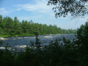
 East Branch Penobscot River, northeast of Millinocket, Maine. | |
| Location | |
| Country | United States |
| Physical characteristics | |
| Source | |
| • location | Maine |
| • elevation | 1,000 feet (300 m) |
| Mouth | |
• location | Penobscot River |
• coordinates | 45°36′32″N 68°32′02″W / 45.60889°N 68.53389°W |
• elevation | 240 feet (70 m) |
| Length | 75 miles (121 km) |
| Basin features | |
| Tributaries | |
| • left | Seboeis River |
The East Branch Penobscot River is a 75.3-mile-long (121.2 km)[1] tributary of Maine's Penobscot River. It flows in Piscataquis County and Penobscot County.
Course
From its source (46°16′01″N 69°12′08″W / 46.2670°N 69.2023°W) in Maine Township 7, Range 11, WELS, in Piscataquis County, the river runs 17 miles (27 km)[1] southeast through the North Maine Woods to Grand Lake Matagamon reservoir, in the northeast corner of Baxter State Park. From Grand Lake Dam, the river runs 48 miles (77 km)[1] south to its confluence with the West Branch Penobscot River in Medway, Penobscot County.
Matagamon Lake
| Grand Lake Matagamon | |
|---|---|
| Coordinates | 46°10′25″N 68°50′33″W / 46.17361°N 68.84250°W |
| Max. length | 8 mi (13 km)[2] |
| Surface area | 4,868 acres (1,970 ha)[3] |
| Max. depth | 95 feet (29 m)[4] |
| Water volume | 80,878 acre⋅ft (99,762,000 m3)[3] |
| Surface elevation | 653 ft (199 m)[5] |
Grand Lake Matagamon or Matagamon Lake is a reservoir on the East Branch, impounded by Grand Lake Dam. The dam was built at the outlet of First Lake, and flooded vast expanses of low-lying land extending upstream to include Second Lake.
The shallow water habitat created by the dam is more suitable for yellow perch, fallfish, and longnose sucker rather than for trout.[4]
See also
References
- ^ a b c U.S. Geological Survey. National Hydrography Dataset high-resolution flowline data. The National Map Archived 2012-03-29 at the Wayback Machine, accessed June 22, 2011
- ^ The Maine Atlas and Gazetteer (Thirteenth ed.). Freeport, Maine: DeLorme Mapping Company. 1988. pp. 51&57. ISBN 0-89933-035-5.
- ^ a b Maine Depts. of Environmental Protection and Inland Fisheries & Wildlife (2005-08-04). "Maine Lakes: Morphometry and Geographic Information". Senator George J. Mitchell Center for Environmental and Watershed Research, The University of Maine. Archived from the original on 2006-09-03. Retrieved 2008-07-31.
- ^ a b "Matagamon Lake" (PDF). Maine Department of Inland Fisheries and Game. State of Maine. Archived from the original (PDF) on 1 February 2017. Retrieved 4 May 2016.
- ^ U.S. Geological Survey Geographic Names Information System: Grand Lake Matagamon


