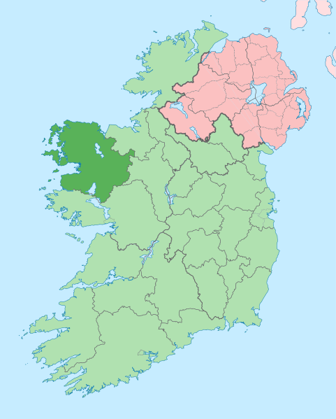
Size of this PNG preview of this SVG file: 481 × 599 pixels. Other resolutions: 192 × 240 pixels | 385 × 480 pixels | 616 × 768 pixels | 822 × 1,024 pixels | 1,643 × 2,048 pixels | 1,450 × 1,807 pixels.
Original file (SVG file, nominally 1,450 × 1,807 pixels, file size: 642 KB)
File history
Click on a date/time to view the file as it appeared at that time.
| Date/Time | Thumbnail | Dimensions | User | Comment | |
|---|---|---|---|---|---|
| current | 14:01, 28 June 2020 |  | 1,450 × 1,807 (642 KB) | Chipmunkdavis | Per the Local Government Reform Act 2014, joining both Tipperarys and both Waterfords (and removing Limerick City code). Colouring in islands, cleaning up and grouping code to remove stray objects and show Galway and Lough Ree. |
| 00:58, 19 July 2010 |  | 1,450 × 1,807 (815 KB) | Mabuska | {{Information |Description={{en|The island of Ireland, showing international border between Northern Ireland and Republic of Ireland, traditional provinces, traditional counties, and local authority areas in the Republic of Ireland and Northern Ireland.}} |
File usage
More than 100 pages use this file. The following list shows the first 100 pages that use this file only. A full list is available.
- Achill Sound
- Aghalard Castle
- Aghamore, County Mayo
- An Caiseal
- Ardagh, County Mayo
- Askill
- Balla Round Tower
- Ballintubber
- Ballycong
- Ballycroy, County Mayo
- Ballydavock
- Ballymore Lough
- Barrclashcame
- Bekan, County Mayo
- Belderrig
- Bellavary
- Ben Gorm
- Black River (Ireland)
- Bohalis
- Breaffy
- Caher Island
- Carracastle
- Castlehill, County Mayo
- Charlestown-Bellahy
- Cloghans
- Cogaula
- Collanmore Island
- Corranabinnia
- Corraun Peninsula
- Corraveggaun West
- Corrimbla
- Corroy, County Mayo
- County Mayo
- Cregganbaun
- Cross, County Mayo
- Cross Lough
- Delphi, County Mayo
- Derrew
- Dooega
- Doon Castle
- Dooncastle
- Drummin, County Mayo
- Errew
- Fahy, County Mayo
- Forrew
- Glenhest
- Gweesalia
- Illanmaster
- Inishbiggle
- Inishcottle
- Inishdalla
- Inishlyre
- Irishtown, County Mayo
- Joyce Country
- Keel, County Mayo
- Keem Bay
- Kilfian
- Knockmore, County Mayo
- Lecanvey
- Levally Lough
- List of loughs of County Mayo
- List of mountains and hills of County Mayo
- List of rivers of County Mayo
- List of roads of County Mayo
- Lough Carra
- Lough Conn
- Lough Feeagh
- Mayo Intermediate Football Championship
- Mayo Junior Football Championship
- Mayo Senior Football Championship
- Mayo Senior Hurling Championship
- Meelick, County Mayo
- Michael Davitt Bridge
- N84 road (Ireland)
- Nephin Beg Range
- Partry
- Partry Mountains
- Pollagh (Achill)
- Pollatoomary
- Polranny
- R335 road (Ireland)
- River Clare
- Rockfleet Castle
- Shammer
- Shanaghy
- Sheean, Islandeady
- Shrule Castle
- Slieve Carr
- Sraheens, Achill Island
- Strade
- Sáile
- Templenagalliaghdoo
- Tonragee
- Tulrahan
- Uggool Beach
- Wikipedia:Graphics Lab/Map workshop/Archive/2016
- Wikipedia:Graphics Lab/Map workshop/Archive/May 2020
- Wikipedia:Graphics Lab/Map workshop/Archive/Oct 2014
- Wikipedia:Neutral point of view/Noticeboard/Archive 17
- Wikipedia talk:WikiProject Geography/Archive 5
View more links to this file.
Global file usage
The following other wikis use this file:
- Usage on ang.wikipedia.org
- Usage on ar.teknopedia.teknokrat.ac.id
- Usage on arz.wikipedia.org
- Usage on ast.wikipedia.org
- Usage on bg.wikipedia.org
- Usage on ca.wikipedia.org
- Comtat de Mayo
- Castlebar
- Cong
- Plantilla:Comtat Mayo
- Ballina
- Westport (Mayo)
- Gob an Choire
- Eachléim
- Béal Deirg
- Bun an Churraigh
- Dún Ibhir
- Dumha Éige
- An Caiseal
- Sáile
- Tuar Mhic Éadaigh
- Béal an Mhuirthead
- Ceathrú Thaidhg
- Gleann an Ghad
- Ros Dumhach
- Iorras
- Illa de Clare
- Doohoma
- Gweesalia
- Bangor Erris
- Crossmolina
- Killala
- Kilcummin
- Turlough
- Usage on ceb.wikipedia.org
- Usage on cs.wikipedia.org
- Usage on de.wikivoyage.org
- Usage on en.wikivoyage.org
- Usage on eo.wikipedia.org
- Usage on es.teknopedia.teknokrat.ac.id
- Usage on et.wikipedia.org
- Usage on eu.wikipedia.org
View more global usage of this file.


