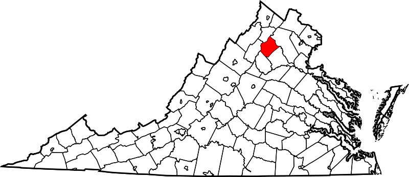
Size of this PNG preview of this SVG file: 800 × 347 pixels. Other resolutions: 320 × 139 pixels | 640 × 278 pixels | 1,024 × 444 pixels | 1,280 × 555 pixels | 2,560 × 1,110 pixels | 2,495 × 1,082 pixels.
Original file (SVG file, nominally 2,495 × 1,082 pixels, file size: 159 KB)
File history
Click on a date/time to view the file as it appeared at that time.
| Date/Time | Thumbnail | Dimensions | User | Comment | |
|---|---|---|---|---|---|
| current | 08:07, 5 July 2024 |  | 2,495 × 1,082 (159 KB) | Nux | fix rendering (remove clipping), uniform colors |
| 17:54, 12 February 2006 |  | 7,486 × 3,247 (223 KB) | David Benbennick | {{subst:User:Dbenbenn/clm|county=Rappahannock County|state=Virginia|type=county}} |
File usage
The following 46 pages use this file:
- Amissville, Virginia
- Boston, Culpeper and Rappahannock Counties, Virginia
- Castleton, Virginia
- Chester Gap, Virginia
- Estes, Virginia
- Five Forks, Rappahannock County, Virginia
- Flint Hill, Rappahannock County, Virginia
- Fourway, Rappahannock County, Virginia
- Hawlin, Virginia
- Hazel River
- Hogback Mountain (Shenandoah National Park, Virginia)
- Huntly, Virginia
- Jordan River (Virginia)
- Keysville, Rappahannock County, Virginia
- Laurel Mills, Virginia
- List of census-designated places in Virginia
- List of cities and counties in Virginia
- Massanova, Virginia
- National Register of Historic Places listings in Rappahannock County, Virginia
- Neighbor Mountain
- Peola Mills, Virginia
- Pignut Mountain
- Rappahannock County, Virginia
- Reager, Virginia
- Rediviva, Virginia
- Rock Mills, Virginia
- Rose Hill, Rappahannock County, Virginia
- Round Hill, Rappahannock County, Virginia
- Rush River (Virginia)
- Scrabble, Virginia
- Shenandoah Homesteads Project, Virginia
- Slate Mills, Virginia
- Smedley, Virginia
- Sperryville, Virginia
- Thornton River
- Viewtown, Virginia
- Wakefield Manor, Virginia
- Washington, Virginia
- Woodville, Virginia
- User:LBourne/Scratch pad
- User:Nyttend/County templates/VA/2
- User:Nyttend/Virginia NRHP/Rappahannock
- Template:RappahannockCountyVA-geo-stub
- Template:Rappahannock County, Virginia
- Category:Populated places in Rappahannock County, Virginia
- Category:Rappahannock County, Virginia
Global file usage
The following other wikis use this file:
- Usage on ar.teknopedia.teknokrat.ac.id
- Usage on bpy.wikipedia.org
- Usage on cdo.wikipedia.org
- Usage on ceb.wikipedia.org
- Usage on ce.wikipedia.org
- Usage on cy.wikipedia.org
- Usage on de.teknopedia.teknokrat.ac.id
- Usage on es.teknopedia.teknokrat.ac.id
- Usage on eu.wikipedia.org
- Usage on fa.teknopedia.teknokrat.ac.id
- Usage on fi.wikipedia.org
- Usage on fr.teknopedia.teknokrat.ac.id
- Usage on glk.wikipedia.org
- Usage on hu.wikipedia.org
- Usage on is.wikipedia.org
- Usage on it.teknopedia.teknokrat.ac.id
- Usage on ja.wikipedia.org
- Usage on ko.wikipedia.org
- Usage on mzn.wikipedia.org
- Usage on nds.wikipedia.org
- Usage on nl.teknopedia.teknokrat.ac.id
- Usage on pl.teknopedia.teknokrat.ac.id
- Usage on pnb.wikipedia.org
- Usage on pt.teknopedia.teknokrat.ac.id
- Usage on ro.wikipedia.org
View more global usage of this file.


