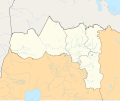
Size of this PNG preview of this SVG file: 512 × 428 pixels. Other resolutions: 287 × 240 pixels | 574 × 480 pixels | 919 × 768 pixels | 1,225 × 1,024 pixels | 2,450 × 2,048 pixels.
Original file (SVG file, nominally 512 × 428 pixels, file size: 1.01 MB)
File history
Click on a date/time to view the file as it appeared at that time.
| Date/Time | Thumbnail | Dimensions | User | Comment | |
|---|---|---|---|---|---|
| current | 22:18, 23 October 2016 |  | 512 × 428 (1.01 MB) | Mikey641 | Another attempt to fix the problem |
| 22:13, 23 October 2016 |  | 512 × 428 (1,006 KB) | Mikey641 | Trying to fix something wierd... In my illustator I dont see that orange weird in the north of ethiopia but here I do | |
| 22:07, 23 October 2016 |  | 512 × 428 (2.24 MB) | Mikey641 | smaller stroke | |
| 22:06, 23 October 2016 |  | 512 × 428 (2.25 MB) | Mikey641 | Added zones | |
| 15:34, 23 October 2016 |  | 512 × 428 (2.09 MB) | Mikey641 | User created page with UploadWizard |
File usage
The following 28 pages use this file:
- 2020 Mekelle airstrikes
- Axum massacre
- Battle of Humera
- Beles, Ethiopia
- Bora massacre
- Dansha
- Debano massacre
- December 2020 Gijet massacre
- Dedebit Elementary School airstrike
- Dengelat massacre
- February 2021 Kola Tembien massacre
- Goda massacre
- Guh massacre
- Hagere Selam (Degua Tembien)
- Hagere Selam massacres
- Hawzen in the Tigray war
- Humera massacre (2020)
- Mahbere Dego massacres
- Mahibere Degue
- Mai Kadra
- Mai Kadra massacre
- Togoga airstrike
- Wukro massacres
- Zalambessa massacre
- Zamr massacre
- Ziban Gedena massacre
- Module:Location map/data/Tigray Region
- Module:Location map/data/Tigray Region/doc
Global file usage
The following other wikis use this file:
- Usage on fr.teknopedia.teknokrat.ac.id
- Usage on he.wikipedia.org
- Usage on ka.wikipedia.org
- Usage on si.wikipedia.org


