| Kaikohe-Bay of Islands volcanic field | |
|---|---|
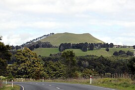
 Te Ahuahu, looking from Waimate North | |
| Highest point | |
| Coordinates | 35°20′54″S 173°50′55″E / 35.348316°S 173.848686°E |
| Geography | |
| Geology | |
| Rock age | |
| Last eruption | 1300 to 1800 years ago |
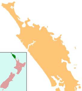
The recently active basaltic Kaikohe-Bay of Islands volcanic field in the Northland Region of New Zealand is associated geographically with an older region of extinct volcanism to its north the Wairakau Volcanic Centre, meaning eruptions in this region have occurred over the last 20 million years.[1] All the cones older than 2 million years have eroded away, leaving plateaus from Ōkaihau to Kerikeri and north to Whangaroa from the old andesite/dacite stratovolcanoes of the Wairakau Volcanic Centre and the ten million year old or more recent volcanoes in field towards the south. In the southern part of the field, around 12 small basaltic scoria cones, and a rhyolite dome erupted in the last 500,000 years around Kaikohe. The field is considered dormant, rather than extinct.[2]

Tectonics
The field is part of the eastern Northland volcanic belt which extends south to the Whangārei volcanic field near Whangārei and the south east volcanics of the Taurikura volcanic complex as found in the Hen of the Hen and Chicken Islands. In the north this belt extends towards the Three Kings Ridge.[1] As such, a large number and types of volcanics are adjacent. It is arc related to the continent-backarc transform Vening Meimesz fault zone to the east of the present Northland land mass which is the eastern boundary of the Northland Allochthon in Zealandia.[6]
List of volcanoes
The volcanoes in the southern part of the field include:[2]
- Kaikohe Hill
- Maungaturoto
- Pouerua
- Putahi
- Tarahi
- Tauanui
- Te Ahuahu
- Te Puke – last erupted 1300 to 1800 years ago[7]

References
- ^ a b Booden, Mathijs A.; Smith, Ian E.M.; Black, Philippa M.; Mauk, Jeffrey L. (2011). "Geochemistry of the Early Miocene volcanic succession of Northland, New Zealand, and implications for the evolution of subduction in the Southwest Pacific". Journal of Volcanology and Geothermal Research. 199 (1–2): 25–37. doi:10.1016/j.jvolgeores.2010.10.006. ISSN 0377-0273.
- ^ a b c Hayward, Bruce; Smith, Ian (2002). "Field Trip 7: A Taste of Northland Geology" (PDF). In Smith, Vicki; Grenfell, Hugh (eds.). Field Trip Guides, GSNZ Annual Conference "Northland 2002". Geological Society of NZ Miscellaneous Publication 112B. Retrieved 28 March 2012.
- ^ Mulheim, M. (1973). Volcanic geology of the Kaikohe area, Northland (Thesis).
- ^ Shane, Phil (2007). "Project: The evolution of basaltic volcanism in Northland in space and time Earthquake Commission Grant (project 09/U585)" (PDF). Retrieved 11 December 2022.
- ^ GNS Science - Geological Map of New Zealand
- ^ Herzer, R.H.; Davy, B.W.; Mortimer, N.; Quilty, P. G.; Chaproniere, G. C. H.; Jones, C. M.; Crawford, A. J.; Hollis, C. J. (2009). "Seismic stratigraphy and structure of the Northland Plateau and the development of the Vening Meinesz transform margin, SW Pacific Ocean". Mar Geophys Res. 30: 21–60. doi:10.1007/s11001-009-9065-1. S2CID 129934775.
- ^ "Kaikohe-Bay of Islands". Global Volcanism Program. Smithsonian Institution. Retrieved 28 March 2021.


