| Kemsley | |
|---|---|
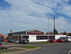
 Village hall, Kemsley | |
Location within Kent | |
| Population | 6,100 (2005)[1] 7,621 (2011)[2] |
| OS grid reference | TQ905660 |
| District | |
| Shire county | |
| Region | |
| Country | England |
| Sovereign state | United Kingdom |
| Post town | Sittingbourne |
| Postcode district | ME10 |
| Police | Kent |
| Fire | Kent |
| Ambulance | South East Coast |
| UK Parliament | |
Kemsley, once a separate village, is now a suburb of Sittingbourne in Kent, England.
According to Asserius Menevensis in his contemporary survey, the Danes built a fortress or castle here in 893 at a place called 'Kemsley downe'. This later became 'Castle Rough'.[3]
At the end of the 19th century, the site of the village was simply a row of cottages beside a brick works,[4] located close to the remains of the medieval fortified manor house Castle Rough.

In 1924, with expansion impossible at the old Sittingbourne Paper Mills, owner Edward Lloyd built the new Kemsley Paper Mill, which served by a creek allowed the direct importation of raw materials to the site. At the same time he built a garden village to house his employees, the core of which comprises the modern day Kemsley village. The narrow gauge industrial railway which served the factory is now the preserved Sittingbourne and Kemsley Light Railway, a tourist attraction. Kemsley railway station is on the Sheerness Line.
References
![]() Media related to Kemsley at Wikimedia Commons
Media related to Kemsley at Wikimedia Commons
- ^ "2005 Ward Level Population Estimates" (PDF). Kent County Council. September 2006. Retrieved 20 August 2007.[permanent dead link]
- ^ "Ward population 2011". Neighbourhood Statistics. Office for National Statistics. Retrieved 21 September 2016.
- ^ Hasted, Edward (1799). "Parishes". The History and Topographical Survey of the County of Kent. 6. Institute of Historical Research: 163–192. Retrieved 27 February 2014.
- ^ "Map Page". Archived from the original on 21 November 2008. Retrieved 21 November 2008.


