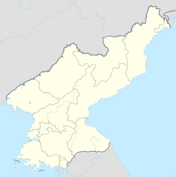
Kunu-dong
군우동 | |
|---|---|
| Korean transcription(s) | |
| • Chosŏn'gŭl | 군우동 |
| • Hancha | 軍隅洞 |
| • McCune-Reischauer | Kunu-dong |
| • Revised Romanization | Gunu-dong |
| Coordinates: 39°42′24″N 125°53′22″E / 39.70667°N 125.88944°E | |
| Country | North Korea |
| Province | South Pyongan |
Kunu-dong (Kunuri) is a village located in South Pyongan Province, North Korea. A key battle of the Korean War, the Battle of Kunu-ri, took place there in November 1950. Kunu-ri was mainly a communication center and a railroad station at the time, and it contains the lateral east-west road which runs from Sinanju on the west coast and Hungnamon the east coast. It is located at the eastern bank of the Chongchon River which parallels the Kunu-ri—Huichon road,[1] and it is also situated at the northern end of the Taedong River valley and on the western slopes of the northern Taebaek Mountains range, generally known as the "Spine of Korea".[2] Kunu-ri is one of the most northern point UN forces managed to reach during the Korean War, which is very near the Chinese border before the massive Chinese attack drove them all the way south. The village was near the location where the US Army 2nd Engineer Battalion burned its colors to prevent their capture by Chinese forces.[3]
Kunu-ri is currently absorbed by the city of Kaechon.
See also
References
- ^ "Archived copy". Archived from the original on 2007-08-22. Retrieved 2008-10-01.
{{cite web}}: CS1 maint: archived copy as title (link) CS1 maint: unfit URL (link) - ^ "Korean War - 2id Kunuri history". Archived from the original on 2008-10-10. Retrieved 2009-01-22.
{{cite web}}: CS1 maint: unfit URL (link) - ^ Janessa Maxilom (November 24, 2013). "White Sands Missile Range burns colors, re-enacts Korea's 'Battle of Kunu-Ri'". Stars and Stripes. New Mexico: Alamogordo Daily News.
On Friday, the White Sands Missile Range 2nd Engineer Battalion commemorated actions performed by their battalion 63 years ago during the Korean War's 'Battle of Kunu-Ri' by burning their unit colors.


