| Mount Orizaba | |
|---|---|
 | |
| Highest point | |
| Elevation | 2,127 ft (648 m) NAVD 88[1] |
| Prominence | 2,127 ft (648 m) |
| Coordinates | 33°22′31″N 118°25′11″W / 33.375147611°N 118.419687114°W[2] |
| Geography | |
| Location | Santa Catalina Island, Los Angeles County, California |
| Topo map | USGS Santa Catalina North |
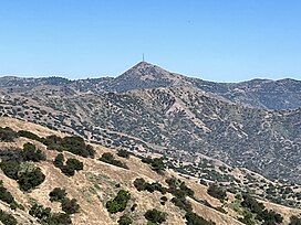
Mount Orizaba is the highest peak on Santa Catalina Island, California, United States. The summit is at 2,097 feet (639 m).[1] On January 10, 1949, 8 inches (200 mm) of snow fell on the mountain.[3] There is an FAA VORTAC installation at the summit.[4] It is named after Pico de Orizaba, the tallest peak in Mexico.
References
- ^ a b "Mount Orizaba, California". Peakbagger.com. Retrieved 2011-05-08.
- ^ "High Mountain Reset". NGS Data Sheet. National Geodetic Survey, National Oceanic and Atmospheric Administration, United States Department of Commerce. Retrieved 2011-05-08.
- ^ "A History of Significant Weather Events in Southern California" (PDF). National Weather Service. Retrieved 2014-03-05.
- ^ "SANTA CATALINA VORTAC". Pilotnav. Dauntless Aviation. Retrieved 10 June 2021.
External links
- "Mount Orizaba". Geographic Names Information System. United States Geological Survey, United States Department of the Interior. Retrieved 2011-05-08.
- "Mount Orizaba". SummitPost.org. Retrieved 2012-12-25.


