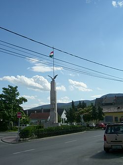
Tahitótfalu | |
|---|---|
 | |
| Coordinates: 47°45′08″N 19°04′41″E / 47.75225°N 19.07808°E | |
| Country | Hungary |
| Region | Central Hungary |
| County | Pest |
| Subregion | Szentendrei |
| Rank | Village |
| Area | |
• Total | 39.17 km2 (15.12 sq mi) |
| Population (1 January 2008)[2] | |
• Total | 5,317 |
| • Density | 140/km2 (350/sq mi) |
| Time zone | UTC+1 (CET) |
| • Summer (DST) | UTC+2 (CEST) |
| Postal code | Tótfalu: 2021, Tahi: 2022 |
| Area code | +36 26 |
| KSH code | 31963[1] |
| Website | www.tahitotfalu.hu |
Tahitótfalu is a village in northern Pest county, Hungary, 28 kilometres (17 mi) north of Budapest on the Buda side. It is a union of two formerly distinct settlements: Tahi, on the mainland, and Tótfalu on Szentendre Island. They are connected by the Tildy Bridge, the only fixed link between Szentendre Island and the mainland.
Etymology
Tahi (lit. 'of Tah') derives its name from the Thah family, who owned much of the land on the Danube's western bank. Tótfalu (lit. 'Slav Village') is named after the village's medieval Slovene inhabitants.[3]
References
- ^ a b Tahitótfalu at the Hungarian Central Statistical Office (Hungarian).
- ^ Tahitótfalu at the Hungarian Central Statistical Office (Hungarian). 1 January 2008;
- ^ "Falutörténet". Tahitótfalu Község Önkormányzata. Village of Tahitótfalu. Retrieved 18 September 2024.
47°45′08″N 19°04′41″E / 47.75225°N 19.07808°E


