This article does not cite any sources. Please help improve this article by adding citations to reliable sources. Unsourced material may be challenged and removed. Find sources: "Achanakal" – news · newspapers · books · scholar · JSTOR (November 2019) (Learn how and when to remove this message) |

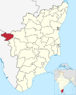
Achanakal is a Badaga village in the Nilgiris district in the Indian state of Tamil Nadu. The village is located adjacent to the Coonoor-Ooty highway in the Ketti valley. The name is believed to be derived from asinikol meaning bamboo sticks in Badaga language which formed the place before the village came into existence. Ketti valley is also considered the second steepest valley in the world.[citation needed] Achanakal is the largest village among the other 13 villages which are located in the valley. The village is just 3 Kilometres away from Ketti and the Lovedale railway stations.
Demographics
[edit]The village is home to 400 families. Melatty, Manapattu and the Main hatti make the village. The village is known for its celebrations of the festivals Maari Habba and Huri Habba. The Maari Habba is celebrated once in a year in the month of March or April for three days.
The village
[edit]The village has a strong sports base, especially football and is home to the Union Club Achanakal, is one of the top ranked Football teams in the district.[citation needed] Achanakal also boasts of its solid contribution to the Indian Army as it has produced many military personnel who serve in the borders and many other parts of the country and some players have represented Tamil Nadu state and the India National football team.[citation needed]
References
[edit]11°22′53″N 76°43′19″E / 11.38139°N 76.72194°E / 11.38139; 76.72194
| District headquarters | |||||||||||
|---|---|---|---|---|---|---|---|---|---|---|---|
| Country | |||||||||||
| State | |||||||||||
| Region | |||||||||||
| Divisions | |||||||||||
| Taluks | |||||||||||
| Revenue blocks | |||||||||||
| Municipalities | |||||||||||
| Towns and villages |
| ||||||||||
| Geography |
| ||||||||||
| History | |||||||||||
| Protected areas | |||||||||||
| Transport | |||||||||||
| Related | |||||||||||
This article related to a location in The Nilgiris District, Tamil Nadu, India is a stub. You can help Wikipedia by expanding it. |
- Pages using gadget WikiMiniAtlas
- Use dmy dates from September 2017
- Use Indian English from September 2017
- All Wikipedia articles written in Indian English
- Articles lacking sources from November 2019
- All articles lacking sources
- All articles with unsourced statements
- Articles with unsourced statements from November 2019
- Coordinates on Wikidata
- All stub articles


