This article needs additional citations for verification. Please help improve this article by adding citations to reliable sources. Unsourced material may be challenged and removed. Find sources: "Cold Northcott" – news · newspapers · books · scholar · JSTOR (July 2012) (Learn how and when to remove this message) |

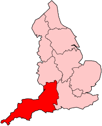
Cold Northcott is a hamlet in Cornwall, England, UK.[citation needed] It is on the A395 road two miles southeast of Hallworthy.[1] It is in the civil parish of St Clether.
Wind farm
[edit]Cold Northcott wind farm is a wind farm situated near the hamlet either side of the A395. It consists of 22 twin-bladed turbines (similar to Great Eppleton) with a nameplate electrical capacity of 6.6 megawatts and estimated annual output of 16 GWh.[2] The turbines began operation in April 1993 (31 years ago) (1993-04) and are manufactured by Cumbrian Wind Farms. Cold Northcott wind farm is operated by a three-man crew of engineers who perform routine maintenance on the wind turbines. The turbines are manufactured by WEG. In early 2016 the 22, twin-bladed, wind turbines were out of use due to health and safety regulations. After being out of use for nearly six months, from June 2016, 20 turbines returned to use. Two turbines are still out of use due to one being struck by lightning. The other turbine, that is out of use, had a faulty gearbox. This then caused the blades to blow off during a storm, which resulted in the whole wind farm closing for nearly six months due to health and safety regulations. During the six months, the crew of engineers carried out maintenance on the operational turbines.
References
[edit]- ^ Ordnance Survey One-inch Map of Great Britain; Bodmin and Launceston, sheet 186. 1961.
- ^ Renewable Energy Cornwall - Cold Northcott Windfarm, accessed 2014-05-25
| Unitary authorities | |
|---|---|
| Major settlements (cities in italics) |
|
| Rivers | |
| Topics | |
| Power stations |
| |||||||||||||||||||||||||||||||||||||||
|---|---|---|---|---|---|---|---|---|---|---|---|---|---|---|---|---|---|---|---|---|---|---|---|---|---|---|---|---|---|---|---|---|---|---|---|---|---|---|---|---|
| Organisations | ||||||||||||||||||||||||||||||||||||||||
50°39′01″N 4°32′26″W / 50.65014°N 4.54069°W / 50.65014; -4.54069
- Pages using gadget WikiMiniAtlas
- Articles with short description
- Short description is different from Wikidata
- Articles needing additional references from July 2012
- All articles needing additional references
- Use dmy dates from October 2019
- All articles with unsourced statements
- Articles with unsourced statements from July 2019
- Coordinates on Wikidata
- All stub articles


