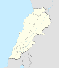
Deir El Aachayer
ديرالعشاير | |
|---|---|
Village | |
 | |
| Country | |
| Governorate | Beqaa Governorate |
| District | Rashaya District |
| Area | |
• Total | 9.9 sq mi (26 km2) |
| Population (2010) | |
• Total | 500 |
| Location | near Rashaya |
|---|---|
| Region | Bekaa Valley |
| Coordinates | 33°35′21″N 36°01′09″E / 33.589181°N 36.019169°E |
| Length | 30 metres (98 ft) |
| History | |
| Builder | Romans |
| Material | Stone |
| Cultures | Greek, Roman |
| Site notes | |
| Condition | Ruins |
| Public access | Yes |
Deir El Aachayer (Arabic: ديرالعشاير) is a village north of Rashaya, in the Rashaya District and south of the Beqaa Governorate in Lebanon.[1]
The municipality is located on the border frontier of the Kaza of Rashaya, one of eight mohafazats (governorates). It sits at a height of 1,250 metres (4,100 ft) above sea level and its surface area covers 2,563 hectares (9.90 sq mi) hectares. The registered population of the village is around 500, predominantly Druze.[2] Actual residents may number only around 250, distributed among about 90 households. The village has a municipal council made up of nine members, and a town mayor. Residents rely on farming as a main source of income, especially grapes, fruit and wheat. Residents also raise and herd sheep and cows, which have been a good source of milk. Farmers in the village have had difficulty selling their products in modern times.[3]
Deir El Aachayer has a number of local springs, including Ain Halalweh, Ain Shayeb, Ain Rouk, Ain Dibb. The village was once known by the name Deir Mar Sema’an, owing to the Monastery of Saint Simon, known locally as Al Borj, said to have been built by the Romans for preaching, religious ceremonies and practices by disciples of Saint Simon the Baptist. The monastery having been a stronghold for the students, enabling them to expand their teaching in Syria.[4]
Roman temple
The village is near to the remains of a substantial Graeco-Roman style temple dedicated to unknown deities, with 30 metres (98 ft) long foundations and columns re-used in local construction.[5] A Greek inscription was found noting that a bench was installed "in the year 242, under Beeliabos, also called Diototos, son of Abedanos, high priest of the gods of Kiboreia". Julien Alquot argued that the bench had liturgical uses as a mobile throne.[6] The era of the gods of Kiboreia is not certain, as is their location, which is not conclusively to be identified with Deir El Aachayer, but was possibly the Roman sanctuary or the name of a settlement in the area. It has been suggested that the name Kiboreia was formed from the Aramaic word kbr, meaning a "place of great abundance".[7]
References
- ^ Geographic.org - Entry about Deir El Aachayer from data supplied by the National Geospatial-Intelligence Agency, Bethesda, MD, USA a member of the Intelligence community of the United States of America
- ^ British Druze Society - Druze communities in the Middle East Archived September 11, 2011, at the Wayback Machine
- ^ "Localiban Entry about Deir El Aachayer". Archived from the original on 2016-03-23. Retrieved 2011-03-29.
- ^ Qada' (Caza) Rachaya - Promenade Tourist Brochure, published by The Lebanese Ministry of Tourism - Entry about Deir El Achayer Archived July 13, 2011, at the Wayback Machine
- ^ George Taylor (1969). The Roman temples of Lebanon: a pictorial guide. Argonaut. Retrieved 29 March 2011.
- ^ Susanne Carlsson (29 April 2010). Hellenistic democracies: freedom, independence and political procedure in some east Greek city-states. Franz Steiner Verlag. ISBN 978-3-515-09265-4. Retrieved 18 September 2012.
- ^ Fergus Millar (1993). The Roman Near East, 31 B.C.-A.D. 337. Harvard University Press. pp. 311–. ISBN 978-0-674-77886-3. Retrieved 18 September 2012.
Bibliography
- Warren, C.; Conder, C.R. (1884). The Survey of Western Palestine: Jerusalem. London: Committee of the Palestine Exploration Fund. (pp. 497-498)


