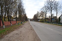
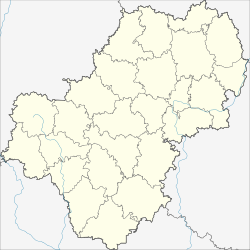
Duminichi
Думиничи | |
|---|---|
 | |
| Coordinates: 53°55′59″N 35°6′20″E / 53.93306°N 35.10556°E | |
| Country | Russia |
| Federal subject | Kaluga Oblast |
| Founded | 1885 |
| Population | |
• Total | 6,326 |
| Time zone | UTC+3 (MSK |
| Postal code(s)[3] | |
| OKTMO ID | 29610151051 |
Duminichi (Russian: Думиничи) is an urban-type settlement and the administrative center of Duminichsky District, Kaluga Oblast, Russia. Population: 5,474 (2021 Census);[4] 6,326 (2010 Census);[1] 7,866 (2002 Census);[5] 7,418 (1989 Soviet census).[6]
History
The settlement of the Duminichsky plant was formed in 1882, when the Bolkhov merchant A.I. Tsyplakov and the landowner of the Zhizdrinsky District I.R.Labunsky began to build an iron foundry in the Nikitinsky forest dacha, which received its name from a nearby village. The settlement that grew up near the plant, which originally consisted of several residential buildings, two factory shelters, a store, a first-aid post and a fire station, was part of the Vertena parish.
The plant was put into operation on February 17 (March 1) 1883, and after that the village began to develop rapidly. Along the roads Bobrovo-Duminichi and Bobrovo-Polyaki, forests were cut down and dwelling houses were built. The population increased mainly due to newcomers - former craftsmen Maltsov enterprises.
In 1887 a 15-bed hospital and a pharmacy were opened, the next year - a 4-grade school, in 1890 the temple of Cosmas and Damian was built. The Duminichi station of the Moscow-Bryansk railway was built in 1898. In 1914 in the village of Duminichsky plant there were 2244 inhabitants, a 3-class zemstvo school worked.[7]
In 1921, a temporary 46 kW power station was equipped on the territory of the iron foundry. At the beginning of the 1930s, 1330 workers were employed at the plant, its annual production was 12 thousand tons.
From January 1, 1926, the village of Duminichsky plant becomes the center of the Duminichsky volost. On October 24, 1927, by the Decree of the Presidium of the Supreme Soviet of the RSFSR, the village received the status of a settlement. Since 1929 it has been the administrative center of the Duminichi district. Since October 1932 it bears its modern name - Duminichi.
A seven-year school was opened in 1930, and a secondary school in 1936.
During the Great Patriotic War, active hostilities were conducted in the Duminichi area. During the occupation (from October 5, 1941) in the Duminichi area, a partisan detachment "For the Motherland" operated under the command of Ilyin Alexander Ivanovich, who died on December 30, 1941, and was posthumously awarded the medal "For Courage", and in the district center itself there was a youth partisan underground (group A. A. Kozlova - I. F. Dubrovsky). During the Moscow battle, it was first liberated from the enemy on January 4-6, 1942, and again abandoned after bloody battles on January 19-21. Particularly fierce battles for the village and the Duminichi station were conducted on January 20-23, 1942 by the regiments of the 328th rifle division of the 10th army. The settlement was finally liberated on April 2, 1942.
During the war, the settlement was almost completely destroyed, only three residential buildings and the former building of the district committee survived. Began to rebuild from 1947. Large-scale housing and industrial construction began in February 1951, when SMU-6 was organized, which employed about 500 people. The number of inhabitants of the village grew rapidly due to visitors from the villages of Duminichsky and neighboring (Ulyanovsky, Zhizdrinsky, Sukhinichsky) districts, and soon exceeded the pre-war level. In 1967 in the village (including the station) there were 7 industrial enterprises, 3 schools, 3 kindergartens, 2 clubs, 4 canteens, 28 shops, and a hospital. pharmacy.
Population
| Year | Pop. | ±% |
|---|---|---|
| 1897 | 1,368 | — |
| 1913 | 2,244 | +64.0% |
| 1920 | 992 | −55.8% |
| 1926 | 1,483 | +49.5% |
| 1931 | 2,058 | +38.8% |
| 1939 | 4,583 | +122.7% |
| 1959 | 6,743 | +47.1% |
| 1970 | 7,734 | +14.7% |
| 1979 | 7,549 | −2.4% |
| 1989 | 7,418 | −1.7% |
| 2002 | 7,866 | +6.0% |
| 2009 | 7,268 | −7.6% |
| 2010 | 6,326 | −13.0% |
| 2011 | 6,283 | −0.7% |
| 2012 | 6,131 | −2.4% |
| 2013 | 5,958 | −2.8% |
| 2014 | 5,821 | −2.3% |
| 2015 | 5,718 | −1.8% |
| 2016 | 5,638 | −1.4% |
| 2017 | 5,594 | −0.8% |
| 2018 | 5,577 | −0.3% |
| 2019 | 5,460 | −2.1% |
| 2020 | 5,438 | −0.4% |
| 2021 | 5,376 | −1.1% |
| The decrease in the population from 2009 to 2010 is explained by the separation of the Duminichi station as a separate settlement. | ||
References
Notes
- ^ a b Russian Federal State Statistics Service (2011). Всероссийская перепись населения 2010 года. Том 1 [2010 All-Russian Population Census, vol. 1]. Всероссийская перепись населения 2010 года [2010 All-Russia Population Census] (in Russian). Federal State Statistics Service.
- ^ "Об исчислении времени". Официальный интернет-портал правовой информации (in Russian). 3 June 2011. Retrieved 19 January 2019.
- ^ Почта России. Информационно-вычислительный центр ОАСУ РПО. (Russian Post). Поиск объектов почтовой связи (Postal Objects Search) (in Russian)
- ^ Russian Federal State Statistics Service. Всероссийская перепись населения 2020 года. Том 1 [2020 All-Russian Population Census, vol. 1] (XLS) (in Russian). Federal State Statistics Service.
- ^ Federal State Statistics Service (21 May 2004). Численность населения России, субъектов Российской Федерации в составе федеральных округов, районов, городских поселений, сельских населённых пунктов – районных центров и сельских населённых пунктов с населением 3 тысячи и более человек [Population of Russia, Its Federal Districts, Federal Subjects, Districts, Urban Localities, Rural Localities—Administrative Centers, and Rural Localities with Population of Over 3,000] (XLS). Всероссийская перепись населения 2002 года [All-Russia Population Census of 2002] (in Russian).
- ^ Всесоюзная перепись населения 1989 г. Численность наличного населения союзных и автономных республик, автономных областей и округов, краёв, областей, районов, городских поселений и сёл-райцентров [All Union Population Census of 1989: Present Population of Union and Autonomous Republics, Autonomous Oblasts and Okrugs, Krais, Oblasts, Districts, Urban Settlements, and Villages Serving as District Administrative Centers]. Всесоюзная перепись населения 1989 года [All-Union Population Census of 1989] (in Russian). Институт демографии Национального исследовательского университета: Высшая школа экономики [Institute of Demography at the National Research University: Higher School of Economics]. 1989 – via Demoscope Weekly.
- ^ Под ред. Ф. Ф. Кадобнова (1914). "Список населенных мест Калужской губернии". Калуга: Калуж. губ. стат. ком. p. 22. [List of populated areas of the Kaluga province. Kaluga: Kaluzh. gub. stat. com. Edited by F.F.Kadobnov. 1914. p. 22.]
Sources
- Законодательное Собрание Калужской области. №473 27 марта 1996 г. «Устав Калужской области», в ред. Закона №681-ОЗ от 27 февраля 2015 г. «О внесении изменений в Устав Калужской области». Опубликован: "Весть", №79, 9 апреля 1996 г. (Legislative Assembly of Kaluga Oblast. #473 March 27, 1996 Charter of Kaluga Oblast, as amended by the Law #681-OZ of February 27, 2015 On Amending the Charter of Kaluga Oblast. ).
- Законодательное Собрание Калужской области. Закон №369-ОЗ от 1 ноября 2004 г. «Об установлении границ муниципальных образований, расположенных на территории административно-территориальных единиц "Думиничский район", "Кировский район", "Медынский район", "Перемышльский район", "Сухиничский район", "Тарусский район", "Юхновский район", и наделении их статусом городского поселения, сельского поселения, муниципального района», в ред. Закона №728-ОЗ от 29 мая 2015 г. «О внесении изменений в Закон Калужской области "Об установлении границ муниципальных образований, расположенных на территории административно-территориальных единиц "Думиничский район", "Кировский район", "Медынский район", "Перемышльский район", "Сухиничский район", "Тарусский район", "Юхновский район", и наделении их статусом городского поселения, сельского поселения, муниципального района"». Вступил в силу после вступления в силу Закона Калужской области "Об изменении статуса населённых пунктов, расположенных на территории административно-территориальных единиц "Думиничский район", "Кировский район", "Медынский район", "Перемышльский район", "Сухиничский район", "Тарусский район", "Юхновский район" Калужской области", но не ранее чем через десять дней после его официального опубликования. Опубликован: "Весть", №336–338, 10 ноября 2004 г. (Legislative Assembly of Kaluga Oblast. Law #369-OZ of November 1, 2004 On Establishing the Borders of the Municipal Formations Located on the Territory of the Administrative-Territorial Units of "Duminichsky District", "Kirovsky District", "Medynsky District", "Peremyshlsky District", "Sukhinichsky District", "Tarussky District", "Yukhnovsky District", and on Granting Them the Status of an Urban Settlement, Rural Settlement, Municipal District, as amended by the Law #728-OZ of May 29, 2015 On Amending the Law of Kaluga Oblast "On Establishing the Borders of the Municipal Formations Located on the Territory of the Administrative-Territorial Units of "Duminichsky District", "Kirovsky District", "Medynsky District", "Peremyshlsky District", "Sukhinichsky District", "Tarussky District", "Yukhnovsky District", and on Granting Them the Status of an Urban Settlement, Rural Settlement, Municipal District". Effective as of after the Law of Kaluga Oblast "On Changing the Status of the Inhabited Localities Located on the Territory of the Administrative-Territorial Units of "Duminichsky District", "Kirovsky District", "Medynsky District", "Peremyshlsky District", "Sukhinichsky District", "Tarussky District", "Yukhnovsky District" of Kaluga Oblast" takes effect, but no earlier than after ten days since the official publication have passed.).


